Background
In our earlier Blog, “Formation of the Falls Run Gorge,” we discussed the potential dynamics of how the Gorge and Falls formed during the end of the Laurentide Ice Age over 12,000 years ago. Further review of literature on similar gorges in Ohio and New York allowed us to refine these dynamics further and provide more detail into how Falls Run was able to sculpt its deep Gorge on its journey to the confluence with Elk Creek to the north.
To do this, we need to look at two defining geographical features present in Erie County and how they played pivotal roles in creating an environment where waters of the melting Laurentide ice sheet led to the formation of the Gorge.
Defining Feature 1: The Portage Escarpment
The Portage Escarpment is the defining feature of upstate New York, northwestern Pennsylvania, and northeastern Ohio. It marks the boundary between the Lake Erie Plain to the north and the Allegheny Plateau to the south. Its close proximity to Lake Erie creates a narrow but easily traveled corridor between the Mohawk Valley region of upstate New York and the Midwest region of the central United States.
This plain’s corridor north of the Escarpment provided one of the few natural low-lying routes from the Atlantic Seaboard into the North American interior. Settlement of northwestern PA and most of Ohio occurred along this route from the early 1800’s onward.
It takes its “Portage” name from the French, as they needed to portage their vessels over it between Lake Erie and the streams flowing south toward Pittsburgh in the 1700s.
Map of the Portage Escarpment (black line) in New York, Pennsylvania, and Ohio

The Wisconsin glaciation of eastern North America occurred over the past 100,000 years. During this time, massive ice sheets covered nearly all of Canada, and its furthest reaches covered all of what is the Great Lakes region of the United States. Reaching its peak about 20,000 years ago, it is responsible for much of the topography of northern Ohio, northwestern Pennsylvania, and upstate New York, including the Finger Lakes region.
The advancing glacier essentially gouged out the Great Lakes basin, especially lakes Michigan, Huron, and Erie. As it relentlessly moved south, it began to sweep up and over the Portage Escarpment. In upstate New York, the escarpment presented a significant barrier to the advancing glaciers, but lobes of the glacier did break over the escarpment, creating the Finger Lakes of today.
Here in northwestern Pennsylvania, the glacier swept over the Devonian-era shale terrain south of Lake Erie. After its retreat, it left a series of terraces and gradual elevation rises that define the present-day Escarpment. This area of the escarpment is 4 to 6 miles south of Lake Erie, rising 200-300 feet above the Lake Plain. As Route 98 heads south from Elk Creek, the Ryan Hill climb to Howard Falls is up the Portage Escarpment.
Laurentide Ice Sheet near the peak of the Wisconsin Glaciation, around 15,000 years ago

Defining Feature 2: The St. Lawrence Continental Divide
The second defining geographical feature within all of Erie County, PA is the St. Lawrence Continental Divide. Just a few miles south of the Portage Escarpment, the Divide cuts diagonally across the landscape (pink line in map below). Streams north of the St. Lawrence Divide flow down the Escarpment into Lake Erie. Streams to the south of the Divide flow toward Pittsburgh and the Ohio River.
Thus, moving south from Lake Erie, one first encounters the elevation rise of the Escarpment at about 4-6 miles inland. After climbing the Escarpment, another gradual elevation increase for 3 miles brings one to the St. Lawrence Divide.
Continental Divides in North America
St Lawrence Divide in Pink cutting across Erie County, PA

Falls Run and the Falls Run Gorge
Falls Run, like most Erie County streams that flow north to Lake Erie, has its origins near the St. Lawrence Divide. The stream is an unremarkable waterway as it begins to slowly course north toward Lake Erie. It drops only about 150 feet in elevation over a course of 3 miles of meandering through Franklin Township as a surface stream, with a slope of 50 ft./mile.
It then reaches the beginnings of the Portage Escarpment, where the character of the stream channel changes very abruptly. At the escarpment, Falls Run plunges over Howard Falls and continues its way down the Falls Run Gorge for nearly 2 miles until it reaches Elk Creek. Over those miles the stream drops 300 feet in elevation, or 170 ft./mile.
After the Falls Run confluence, Elk Creek continues for 7.5 miles to its confluence with Lake Erie, a slope of only 30 ft./mile. The following table summarizes these zones of the waterways:
| Elevation | Distance | Change | Slope/mile | Main Feature | |
| Lake Erie | 600 | 0.0 | |||
| Elk-Falls Confluence | 850 | 7.5 | 250 | 30 | Lake Erie Plain |
| Howard Falls | 1150 | 1.8 | 300 | 170 | Portage Escaprment |
| St. Lawrence Divide | 1300 | 3.0 | 150 | 50 | Alleghany Plateau |
In comparing the slope of the waterway, it is easy to see how Falls Run flows much more swiftly through the Falls Run Gorge. Nonetheless, that alone could not have created the Gorge, as the volume of water is much too small to have removed the amount of material that was displaced to create a gorge that deep and wide.
There had to be something else of a monumental nature that occurred in the past.
The Ice Sheet Melts
The Laurentide ice sheet began its final push into northwestern Pennsylvania around 21,000 years ago, covering all of Erie County and further south into the region.

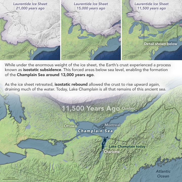
As shown in the above illustration, before 15,000 years ago the ice sheet had melted well back into Canada.
It is hard to visualize the enormity of the lobe of ice sheet that covered NW Pennsylvania 20,000 years ago, being upwards of a mile or more thick. As the glacier finally melted from globally warming temperatures, it released unimaginable quantities of water. The receding Laurentide glacier often melted back at a rate of 300-900 feet per year. At first that melting water flowed south, down new tributaries toward the Ohio River. However, once it receded north of the St Lawrence Divide, waters that could no longer flow south began to pool at the face of the glacier. Finally the receding glacier reached the Portage Escarpment.
At some point the melt-water found its way north under or around lobes of the receding glacier. Once released, this trapped water and more from the continually melting glacier found its way down the escarpment at several places and joined to form Elk Creek. In our area, in addition to Falls Run, Goodban Run, Porter Run, and Little Elk Creek all have their origins at the St Lawrence Divide and once they reached the escarpment, created gorges on their way to Elk Creek.
The following illustration shows Falls Run flowing from the St. Lawrence Divide, down the Portage Escarpment, and into the Elk Creek Valley. Other significant streams flowing over the escarpment are also shown.
Map of the Glacial Deposits of Northwestern PA
Showing Elk Creek and its Tributaries flowing over the Portage Escarpment

Falls Run is located centrally amongst those streams flowing north, and is the only one that has a significant Falls associated with the stream. It is estimated that the flow of water down the Falls Run Gorge during the melting of the Laurentide Ice Sheet must have reached a rate of many thousands of gallons/second for a period of 20-50 years or more in order for that melt-water to drain north to Elk Creek. Put into perspective, this is about 1% of the current flow rate of Niagara Falls!
During this time, most of the Falls Run Gorge was created as its waters eroded into the soft Devonian shale as it flowed forcefully north into the Elk Creek Valley that extends to Lake Erie. Of the tributaries that flowed over the escarpment in Erie County, Falls Run is unique in that those erosional processes also resulted in a significant waterfall, which today is known as Howard Falls, the largest waterfall in northwestern Pennsylvania.
These processes that created the Gorge and the Falls are well known in the Finger Lakes region of upstate New York. As the following illustration shows, many streams in that region demonstrate similar features. The melting glacier feed tributaries vast quantities of water, and as those tributaries flowed down the escarpment they formed eroded gorges, receding waterfalls, and hanging valleys above. Once the glacier has melted, the tributaries returned to much quieter features of the local landscape.
This fully describes Falls Run today.

Images modified from originals by J. Houghton first published in The Teacher-Friendly Guide to the Geology of the Northeastern U.S. by Jane Ansley (published by the Paleontological Research Institution) (Source)
Conclusion
Falls Run Gorge and Howard Falls are products of the Laurentide continental glacier that finally began receding from the area approximately 20,000 years ago. That retreat released vast amounts of melt-water that could not flow south over the St. Lawrence divide. Instead those melt-waters flowed north down the Portage Escarpment during that time, eroding the gorge and creating its associated waterfall at the head of the gorge. By 15,000 years ago the glacier had receded back into Canada, leaving behind the present Great Lakes and the quiet tributaries that flow into them today.
The erosional forces of today are miniscule compared to the forces in play that initially formed the Gorge. Today the Gorge continues to slowly erode and Howard Falls continues to recede, but at rates almost imperceptible from generation to generation.
That’s just fine, as we love them just as Nature left them for us to experience and enjoy.
D.D.Howard
3 thoughts on “The Portage Escarpment”